Fact Finding Workshop on Remote Sensing Concluded [Archives:2001/43/Business & Economy]
October 22 2001
Yasser M. Ahmad
Yemen Times

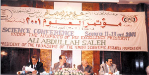
About the aims of the workshops, the Chairman of the Geological survey and the Mineral Wealth, Dr. Ismael Naser Al-Gunaid confirmed that the workshop had two main aims: reviewing the technicality of the current condition and working out on a comprehensive paper related to remote sensing and its use in order to improve Yemen’s situation and helping the decision-makers in the government to adopt measures with a clear vision. He added that the process of remote sensing means taking photographs from space and looking at the changes which may occur on earth. The idea of remote sensing came out to use the limited potentials in the country and bring the efforts together instead of performing these separately. This workshop represents a step towards establishing the center on scientific bases. Consequently, studies were prepared in collaboration with the UNDP Office. It will also be noted here that the experiences of the Arab countries will be integrated in the project.
In the same context, Engineer Abduh Saeed Al-Maktari, the Manager of the Project & the Coordinator of the Workshop, highlighted that establishing the center is of importance in order to provide the necessary information and design accurate maps in all different aspects to facilitate a proper planning by the decision-makers. Moreover, the space data can be obtained from different institutions such as NASA Agencies for instance. He pointed out that the country has been seeking to enter new technological methods through feasibility study carried out by the Canadian Company, Entera Ketting.
We should mention here that the experiences of the different sectors have been assessed with a concentration on the factors of success and failure.
During the workshop, the specialists presented a number of different working papers which are summarized in the following:
In his working paper “Remote Sensing Technology and Application”, Dr. Amin Ali Qahtan concentrated on the changes in the 20th century. He went on saying that the 20th century was characterized by regional and international changes associated with huge information revolutions that spilled over the political, economic, social and cultural life aspects. Recently, the use of remote sensing technology, one of the most modern ways to study the natural resources, to identify their characteristics and sites, and to monitor and exploiting them, was introduced thanks to high-grade technology.
Eng. Fuad Al-Haili said in his working paper that the Republic of Yemen is characterized by its strategic location. It has vast coasts from the Red Sea, Gulf of Aden to the Arabia Sea. In addition, a number of islands can also be found in Yemen’s territorial water. These coasts are rich in marine life and seafood. According to Eng. Al-Haili, new initiatives have been taken regarding various environmental aspects connected to coastal regions.
Eng. Abduh Saeed Abduh Al-Maqtari entitled his working paper “Project of Feasibility for Establishing the Yemen Remote Sensing and Geographic Information System GIS Center.” He said that since the last decade the Republic of Yemen has paid attention to activate the use of remote sensing technology for concerned authorities. The first feasibility study was done by a Canadian company, Intera Ketting. The current feasibility study which was conducted in collaboration with UNDP and (Geological Survey and Mineral Resources Board (GSMRB) pointed two models: a research model and a service model. The fist one is aimed to develop a specialist service agency for acquisition, processing, storing and supplying remotely sensed data. In order to complete the objectives, the feasibility study was disseminated to all stakeholders and Arab and international organizations with expertise in Remote Sensing and GIS technology.
Eng. Abduhmajed Al-Hemiary dealt in his working paper (“Use of Geographic Information Systems and Remote Sensing in Natural Resources Survey in Yemen”) with aerospace remote sensing and GIS technology. He pointed out that the lack of data or its inconsistency show the dire need of establishing a successful implementation of GIS. Since the launching of the first Earth Resources Technology Satellite (ERTS), Yemen has been one of the developing countries which utilized remote sensing data for reviewing natural resources in a drive to develop land planning. The working paper also highlights the integrated use of remote sensing and GIS technology in several fields in order to achieve sustainable agricultural development, such as land suitability mapping, agro-climactically zonation, soil erosion, woodland, and vegetation distribution.
In his working paper, “Application of Geographical System in Urban Planning”, Eng. Kahtan Al-Hadah said that the application of any information system should take into consideration responses and essential tasks and should provide strict accuracy. The idea of developing Geographical Information System (GIS) unit in the Ministry of General Works and Urban Planning appeared when several organizations identified this need, such as the German Technical Cooperation (GTZ) which has been an active participant in this field despite the obstacles faced.
Other working papers were also presented by the participants such as “GIS Applications to Study the tectonic Setting in Yemen” by Dr. Khaled Khanbari. In his working paper, Dr. Khanbari dealt with the modern technology and its impact on the Yemeni society. He pointed out furthermore that this system is capable of handling both location data and attributes data. One of the most important benefits of the GIS in geology is a geologic mapping involving the identification of land forms, rocks types, and rock structures (folds, faults, fractures) and the display of geologic units and structures on a map in their correct spatial relationship with one another. This paper shows the use of GIS software to study the tectonic setting of the Arabian plate and Gulf of Aden. MGE, an Intergraph software, was used to draw a geologic map of Belhaf Graben (an area in Shabowah) based on image spotting.
In his working paper “Application of Remote Sensing in Gas Fields,” Dr. Refat Abdulhak Mohammed Saif deals with gas and oil industries and remote sensing application in different fields such as prospecting, exploration, production, and storage. Yemen is one of these countries willing to establish a strategy to develop its oil and gas industry. New resources can be found by using modern scientific methods and experience exchange.
In conclusion, the participants focused in their working papers on the Remote Sensing Technology in all its aspects: economics, industries, minerals, marine biology, or space.
——
[archive-e:43-v:2001-y:2001-d:2001-10-22-p:./2001/iss43/b&e.htm]


